We utilize geospatial technology to uncover geographical secrets and aid in exploration.

Has 4 main products: Wide Map, City Map, POI and Road.

City map provides information about all objects on the map.
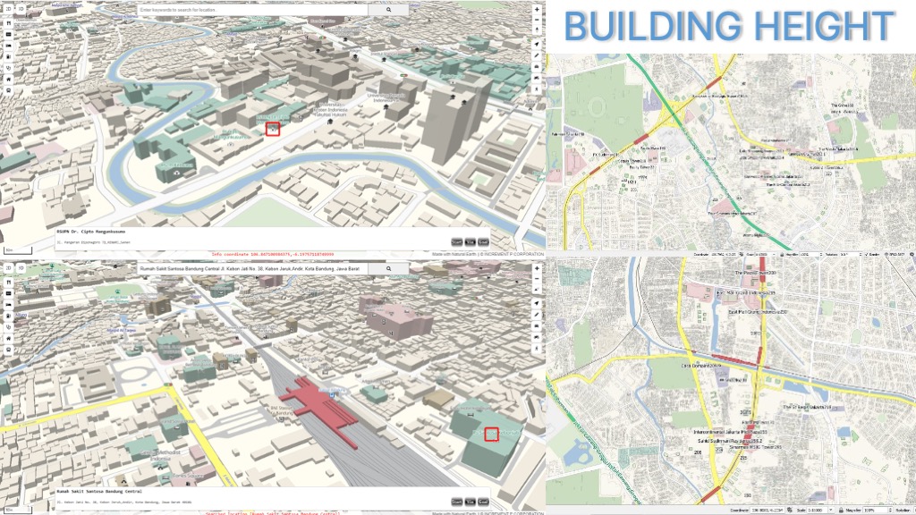
City map provides building height information.
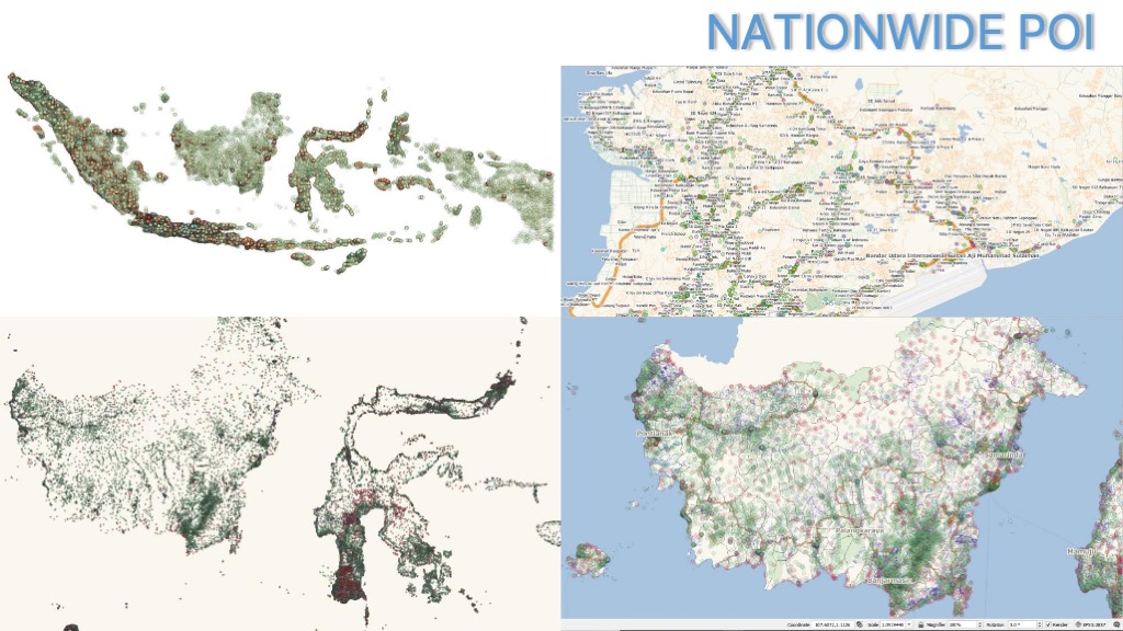
POI provides detailed information about a place.

POI can be used to analyze the characteristics of a location.
